CoMaps 오프라인 지도 앱 대상 Android 설명
A community-led free & open source maps app based on OpenStreetMap data and reinforced with commitment to transparency, privacy and being not-for-profit. CoMaps is a fork/spin-off of Organic Maps, which in turn is a fork of Maps.ME.
Read on about reasons for the project and its direction at codeberg.org/comaps. Join the community there and help make the best maps app
- Use the app and spread the word about it
- Give feedback and report issues
- Update map data in the app or on the OpenStreetMap website
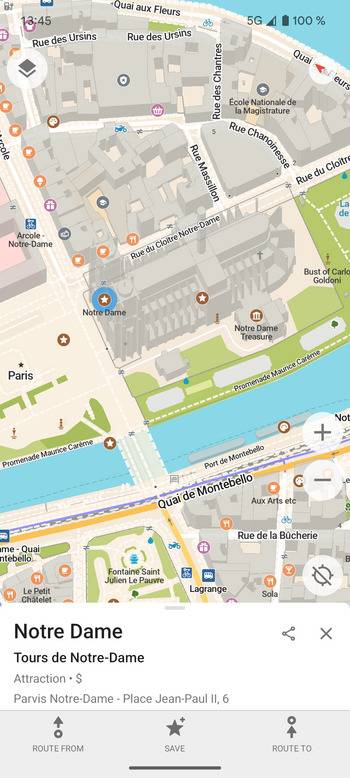
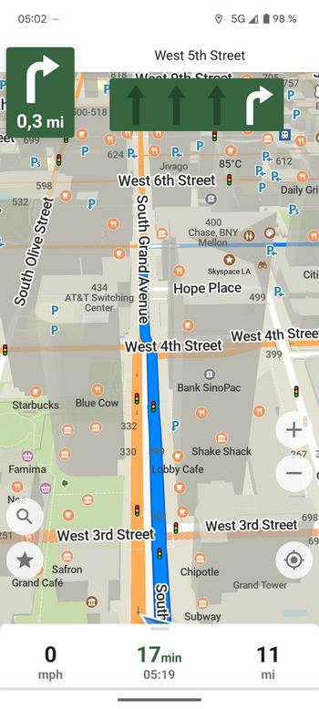
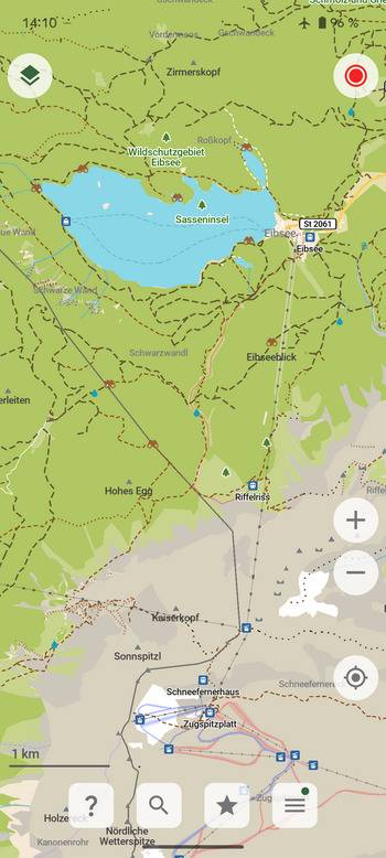
‣ Offline-focused: Plan and navigate your trip abroad without the need for cellular service, search waypoints while on a distant hike, etc. All app functions are designed to work offline.
‣ Respecting Privacy: The app is designed with privacy in mind - does not identify people, does not track, and does not collect personal information. Ads-free.
‣ Simple and Polished: essential easy to use features that just work.
‣ Saves Your Battery and Space: Doesn’t drain your battery like other navigation apps. Compact maps save precious space on your phone.
‣ Free and Built by the Community: People like you helped build the app by adding places to OpenStreetMap, testing and giving feedback on features and contributing their development skills and money.
‣ Open and Transparent Decision-making and Financials, Not-for-profit and Fully Open Source.
Main Features:
- Downloadable detailed maps with places which are not available with Google Maps
- Outdoor mode with highlighted hiking trails, campsites, water sources, peaks, contour lines, etc
- Walking paths and cycleways
- Points of interest like restaurants, gas stations, hotels, shops, sightseeings and many more
- Search by name or an address or by point of interest category
- Navigation with voice announcements for walking, cycling, or driving
- Bookmark your favorite places with a single tap
- Offline Wikipedia articles
- Subway transit layer and directions
- Track recording
- Export and import bookmarks and tracks in KML, KMZ, GPX formats
- A dark mode to use during the night
- Improve map data for everyone using a basic built-in editor
Freedom Is Here Discover your journey, navigate the world with privacy and community at the forefront!